SERVICES
– For prints of existing maps, check out the Shop –
Need a One of a Kind Map?
Want To See Your Land From an Entirely New Perspective?
I Can make all kinds of maps that focus on particular elements of what is most important to You
- Landscape
- Cityscape
- Farmland
- Water Flow Patterns
- Precipitation
- Soil and Mineral Composition
- Topography and Contour
- Georeferencing (reprojecting) Historic Maps
- Xeriscaping and Rainwater Harvesting
- Perspective and Scale
Unique maps are an investment of time, heart and energy. This is a premium service which requires a collaborative process between the customer and myself while we develop the intention and attributes to be included in your one-of-a-kind map. This takes time and cannot be accomplished elegantly on short notice. When we are done you will have a work of art that speaks directly to your unique interests.
Examples of my work:
LiDAR Based Maps Of Your Neighborhood
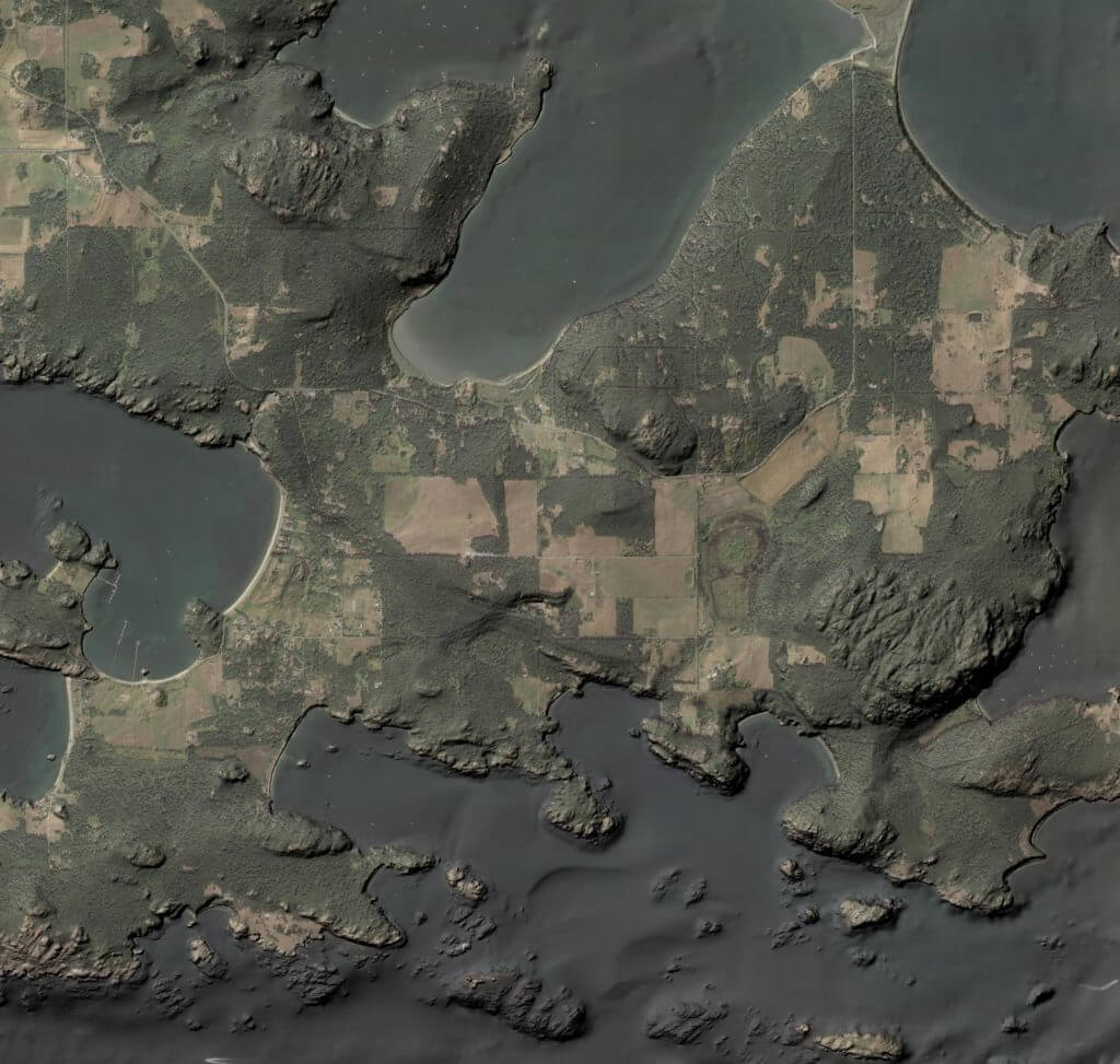
This image shows a satellite image overlaid on a LiDAR hillside that includes both topographic and bathymetric elevations.
You can learn a lot about a place by accessing sophisticated technologies like satellite imagery and LiDAR. The data is often freely available, but dedicated software is necessary to interpret it, and the learning curve is steep. I can help.
Data Visualization
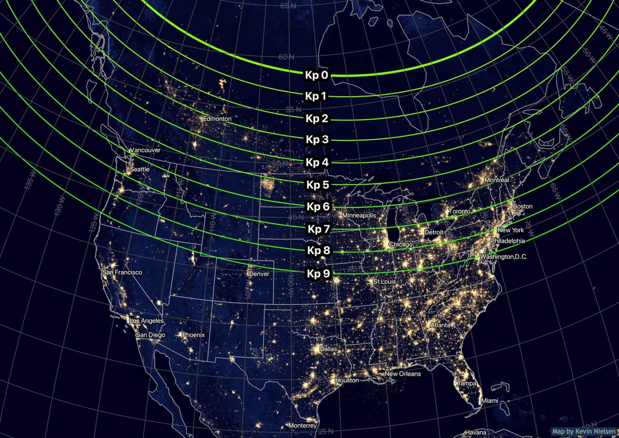
This image helps make a complex concept a little bit easier to understand. The green lines represent the predicted southward boundary of the Aurora Borealis during geomagnetic storms of varying severities. The map is based on data from the 2020 World Magnetic model, NOAA, and NASA. The addition of city lights adds another dimension of utility as well: prospective aurora watchers can locate sources of light pollution and avoid them to find a viewpoint with a darker sky.
Customized Property And Estate Maps
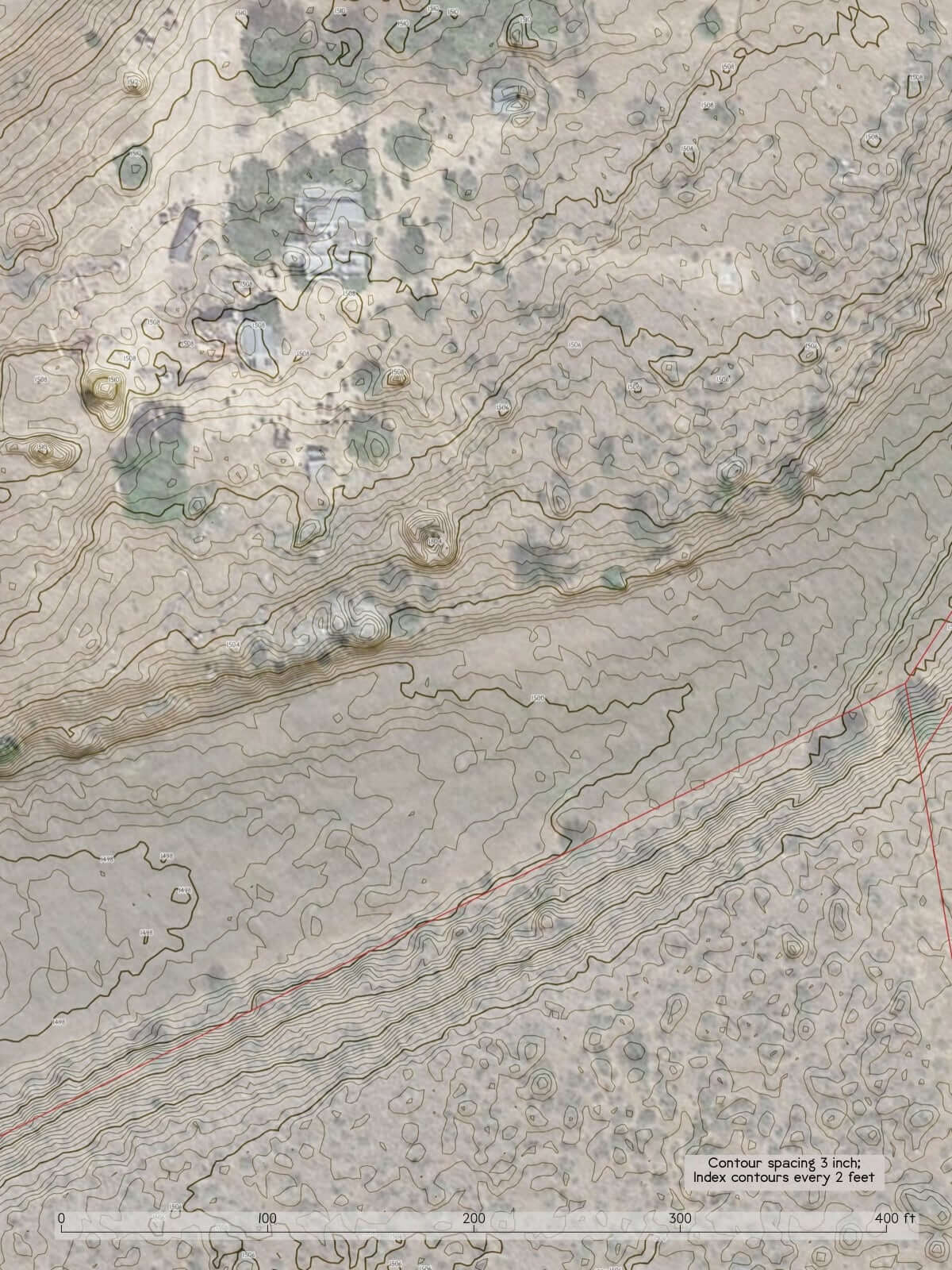
This example shows a 3D hillside overlaid on a satellite photo. There is also an extremely detailed topographical contour layer with a contour spacing of just 3 inches. LiDAR data has become widely available in recent years with huge areas being scanned with such accuracy that they err on the scale of centimeters. This map was made for a family who are using permaculture principles to develop their land; with this they can quickly and easily see how rainwater will flow across their land so that it can be used as a valued resource in an arid climate.
Mapping a Changing World
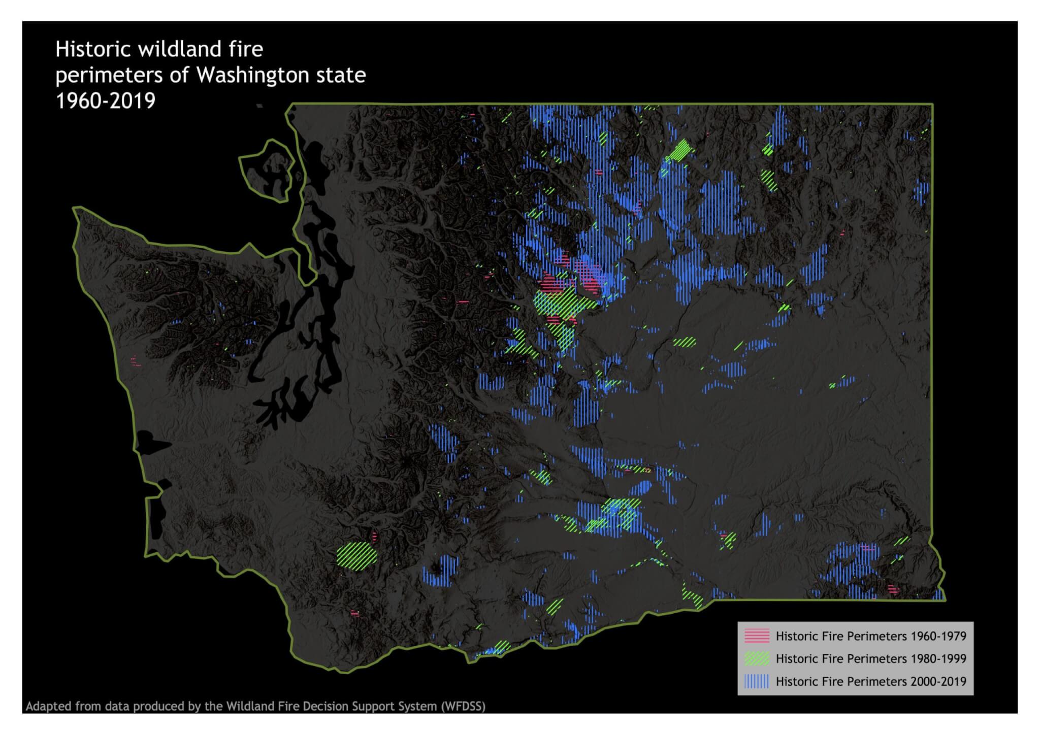
The last decade has seen intense wildfires in western North America. This map uses data from the federal Wildland Fire Decision Support System and the Washington Department of Fish and Wildlife to show the footprints of all the mapped fires of the last 60 years. The colors each represent a 20 year period, with blue representing 2000-2020. The increase in burned area is massive.
We Can Make Your Ideal Map…
Slope Severity Maps
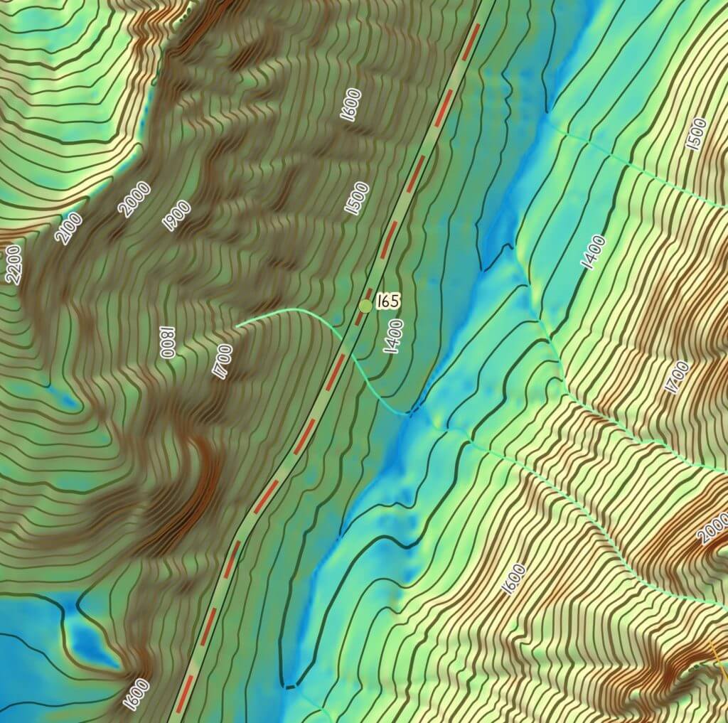
No matter how good you are at interpreting topo map contours, its easier to understand the nuances with a dedicated slope severity map. This map uses variations in color to represent the angle of slope of the terrain.
Visibility Maps
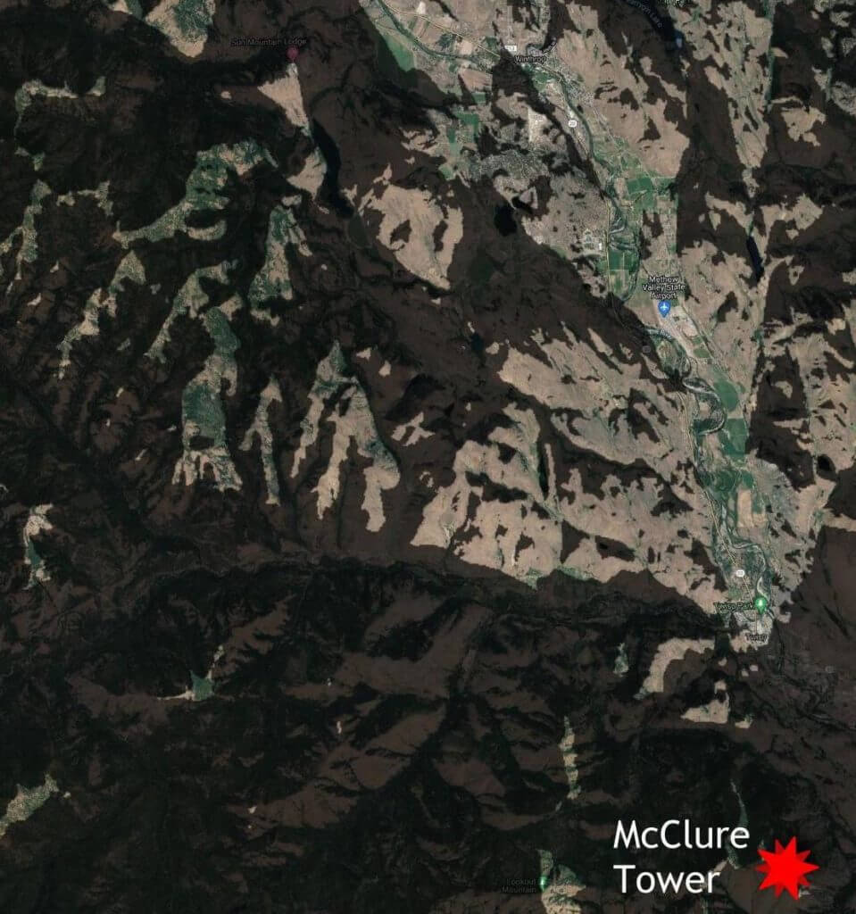
This type of map uses a terrain analysis to show what land is visible from a specific location. The image above is a map I made for a Micro-FM radio station that was considering expanding their coverage area. The map helped them determine which areas have the best radio reception so they could be sure that a second transmitter will have a minimal amount of overlap. These are useful for determining locations for transmitters and fire lookouts, but are also really cool for a house with a view. This type of map is also used to find locations to put things that you don’t want seen, such as unsightly buildings or infrastructure projects. You can determine a location that won’t be seen from nearby roads, for example.